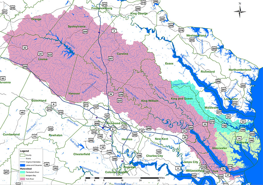
At 3,254 square miles, roughly 7.6% of the Commonwealth’s total land area, the York River and small coastal basins’ watersheds are among the smallest of Virginia’s Chesapeake Bay watersheds, though no less important.
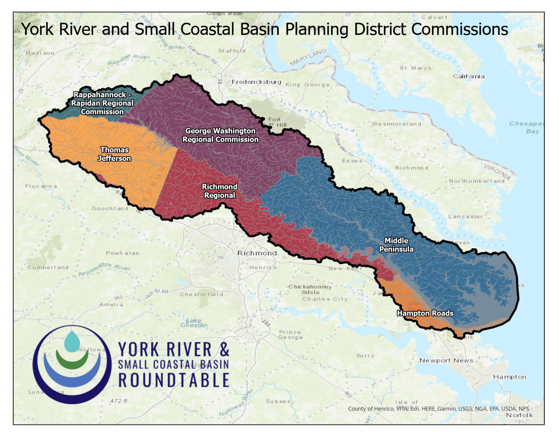
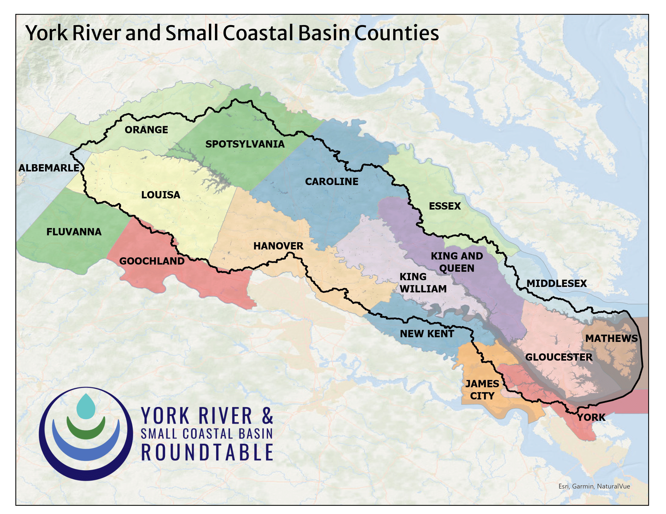
Located within Virginia’s Coastal Plain and Piedmont physiographic provinces, the York River, Mobjack Bay and Piankatank River watershed areas include all, or portions of, 17 counties and one independent city in Virginia.
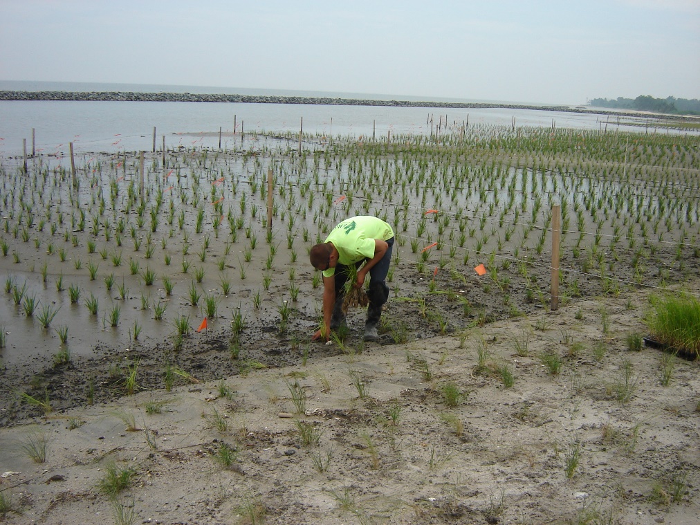
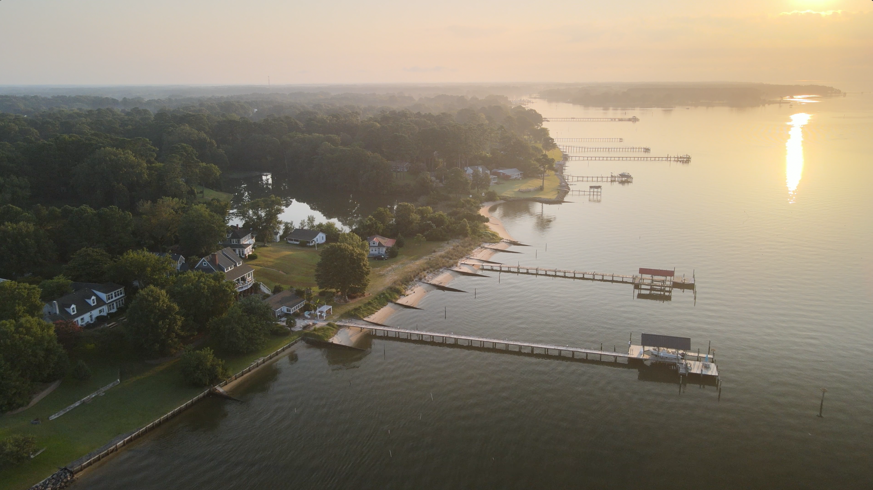
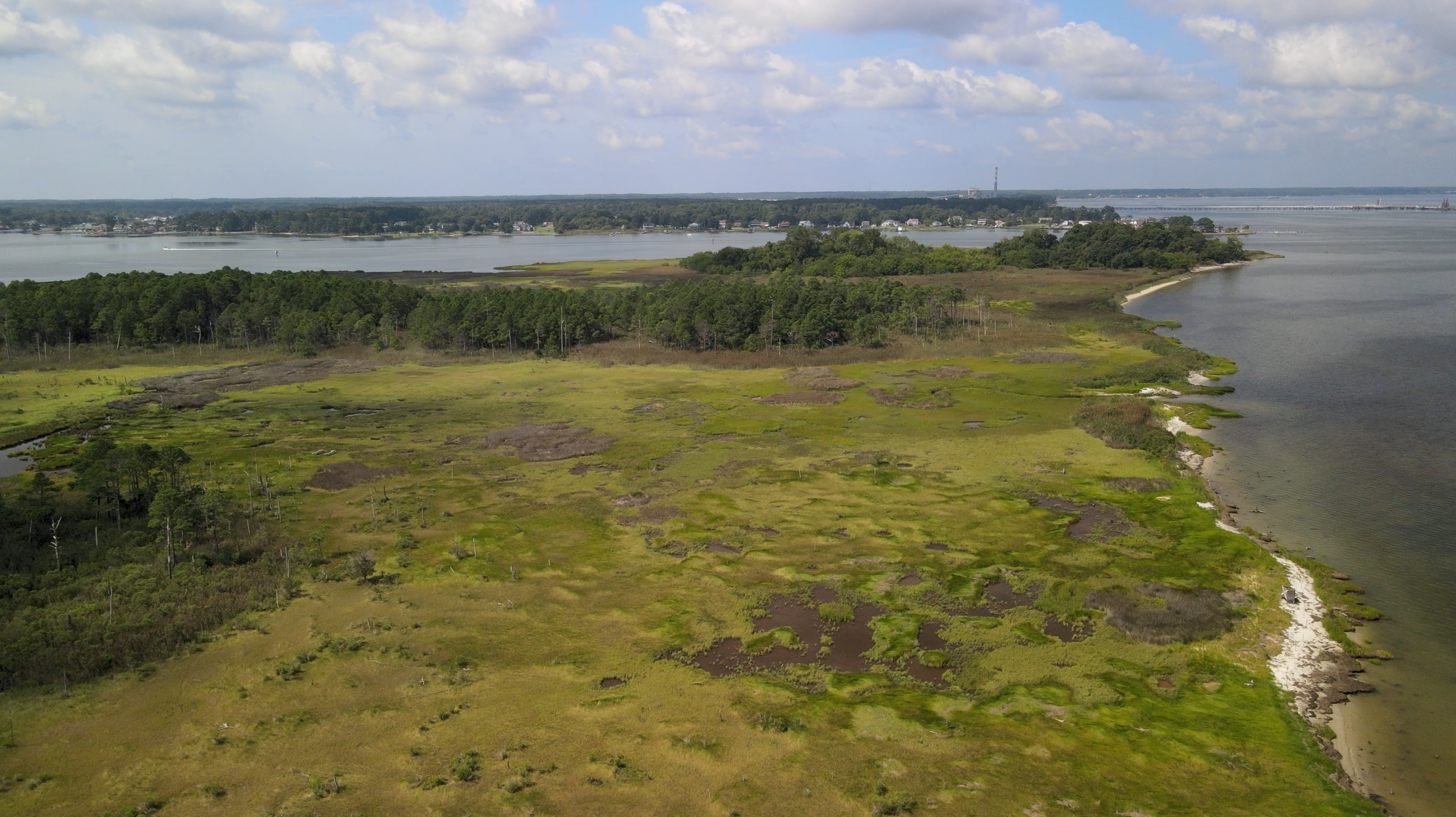
This combined area encompasses approximately 6,700 miles of rivers/streams, 11,330 acres of lakes and 82 square miles of tidal estuary. From the rolling foothills of the Blue Ridge Mountains, to the manmade banks of Lake Anna; the Dragon Run wilderness of the upper Piankatank and oyster reefs of Mobjack Bay; to the forested wetlands along the Pamunkey, and the salt marsh islands of the York, our region includes a diversity of Chesapeake Bay watershed habitats
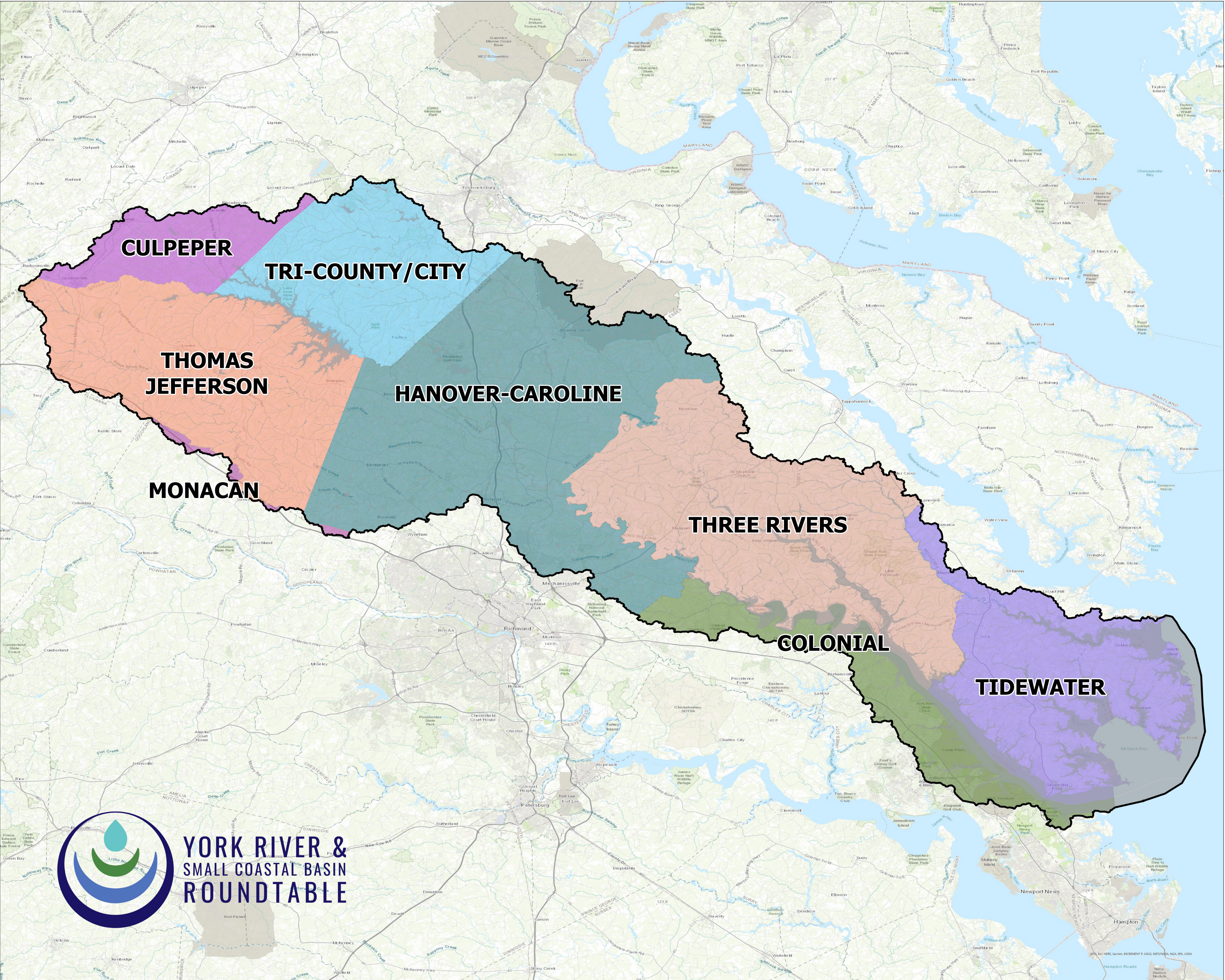 Soil and Water Conservation Districts of the watershed