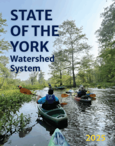
State of the York Watershed System
Image Credit: C. Gonzalez
Beginning in 2021, members of the York River and Small Coastal Basin Roundtable set out to co-produce a comprehensive report that would meet a growing desire for watershed related information. That report is finally here!
The State of the York Watershed System is a contemporary synthesis of the status, trends and opportunities in the York River, Mobjack Bay, and Piankatank River basins.
Journey with us over land and into water as we detail interdependent content in three overarching sections: Our Changing Landscape, Our Water Quality, and The Resources We Steward.
Led by Chesapeake Bay National Estuarine Research Reserve in Virginia, this effort represents the first of its kind since 2000, and incorporates the work and/or input of more than 160 people regionwide on topics including, but not limited to, the following:
- Population demographics and socioeconomics
- Land use/land cover
- Gains and loss to developed and natural land (System-wide)
- Percent change in tidal marsh
- Current extent of marshes and potential for migration
- Projected flooded areas
- High tide flooding, flood risk and road exposure
- Erosion and accretion of shorelines
- Precipitation trends
- Septic hot spots
- Streamflow
- Natural and nature-based solutions including riparian buffers, living shorelines and the shoreline suitable for the latter
- Sediment, nitrogen, phosphorus trends
- Best management practices
- Air temperature trends
- Water temperature trends
- Harmful algal blooms
- Impaired water segments
- Point and nonpoint discharge
- PFAS
- Marine debris
- Community monitoring
- Historic resources
- Oyster landings and leases
- Oyster restoration
- Seagrass cover and trends
- Essential fish habitat
- Commercial fisheries (System-wide)
- Fish passage
- Invasives, including Phragmites and Blue catfish
- Species and habitats of conservation interest and concern
- Conservation lands
- Public access
- Recreational angling – including effort, demographics, stocking, regulations
Creating this tailor fit, made-for-you report inspired the following features. These call-outs appear throughout the document and collectively serve as your launchpad to continued exploration and further study.
Resources
Case Studies
Tool Features
Fast Facts
Did You Know?
Flagged – for more study and development
Calls to Action
The Bottom Line?
System residents and visitors alike all have a responsibility to ensure that our waters remain fishable and swimmable while our population and activity within the System grows and expands.
Positive change within our System is within our sphere of influence:
Creating a ripple effect takes just a DROP!
Check out the report for more! …And to do that….
Dig into (all) the Digital Details
The State of the York Watershed System was made for the digital landscape. Viewing the flipbook (showcased above), thus represents the best way to read and interpret content, link to resources, and gain access to figures. Pro tip: On your phone? Turn it horizontally to flip through the report with ease!
For more tips and tricks on how to navigate the flipbook version and take advantage of all the report features, watch this tutorial:

While we recommend you view online as a flipbook for access to all report features, we know that some prefer a traditional pdf, and plenty of you are eager to get your hands on the print! We have each of these versions ready just for you!
- Click here for pdf as a spread (option for onscreen viewing outside of flipbook)
- Click here for PRINT READY version (best option for in-hand access)
*Please note that each of these versions are compressed. For a file in high resolution, please use the contact button below to email coordinators for a copy.
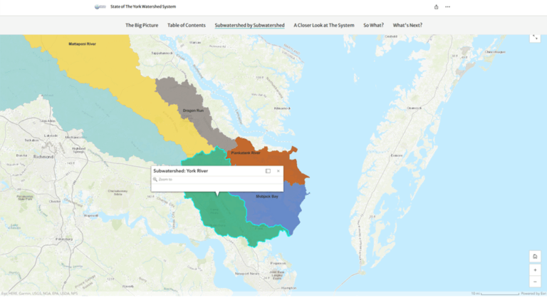
Scroll through our story map
It doesn’t just stop with the report. This story map details report findings for you in another interactive way. Scroll through report take-aways and subwatershed specifics without missing a beat, even if you’re not a page-turner.
But wait, there’s more!
Eager for all the links? Ready to go straight for the sources? We see you – and have your curiosity covered!
Visit our
for all the parts and pieces we pulled from, and send folks to, in the report!
Communications Materials and Contact
Help spread the word on the York Watershed System and the State of the York with the following materials.
- Welcome to the York Watershed System – intro video
- One-Pager (courtesy Green Fin Studio)
- Slides for Sharing and Introducing (courtesy Green Fin Studio)
- Social Media Toolkit
Lingering comments, questions or concerns related to the report, can be directed to:
Backstory
In 2020, the Roundtable released a two-year strategic plan outlining a set of intended products, one of which was a report that provides quality, rigorous, objective science on the state of the York watershed.
Development of the report began with a needs assessment, delivered in partnership with Roundtable collaborators. The team sought input from practitioners and residents in the region through both informational interviews and a survey. Over the course of this NERRS Science Collaborative project, team members analyzed and integrated feedback, updated and coalesced data, drafted case studies, explored resources, and interviewed experts in an effort to create the most comprehensive picture of the York Watershed System developed to date.
Major Contributors

Funding Provided by


